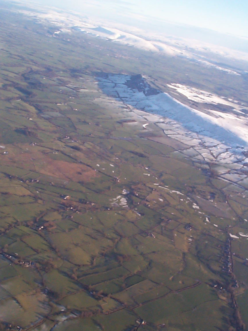
Longridge
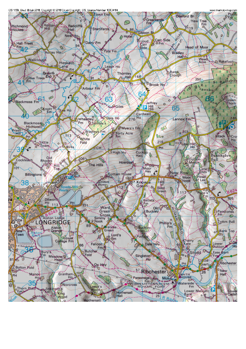
| Wind Directions | NNW-NNE | OS Ref | SD 644 406 Sheet 102 |
|---|---|---|---|
| Height ASL | 1000ft (300m) | Rating | CP |
| Top to Bottom | Varies | Notam | Give OS Ref |
Directions
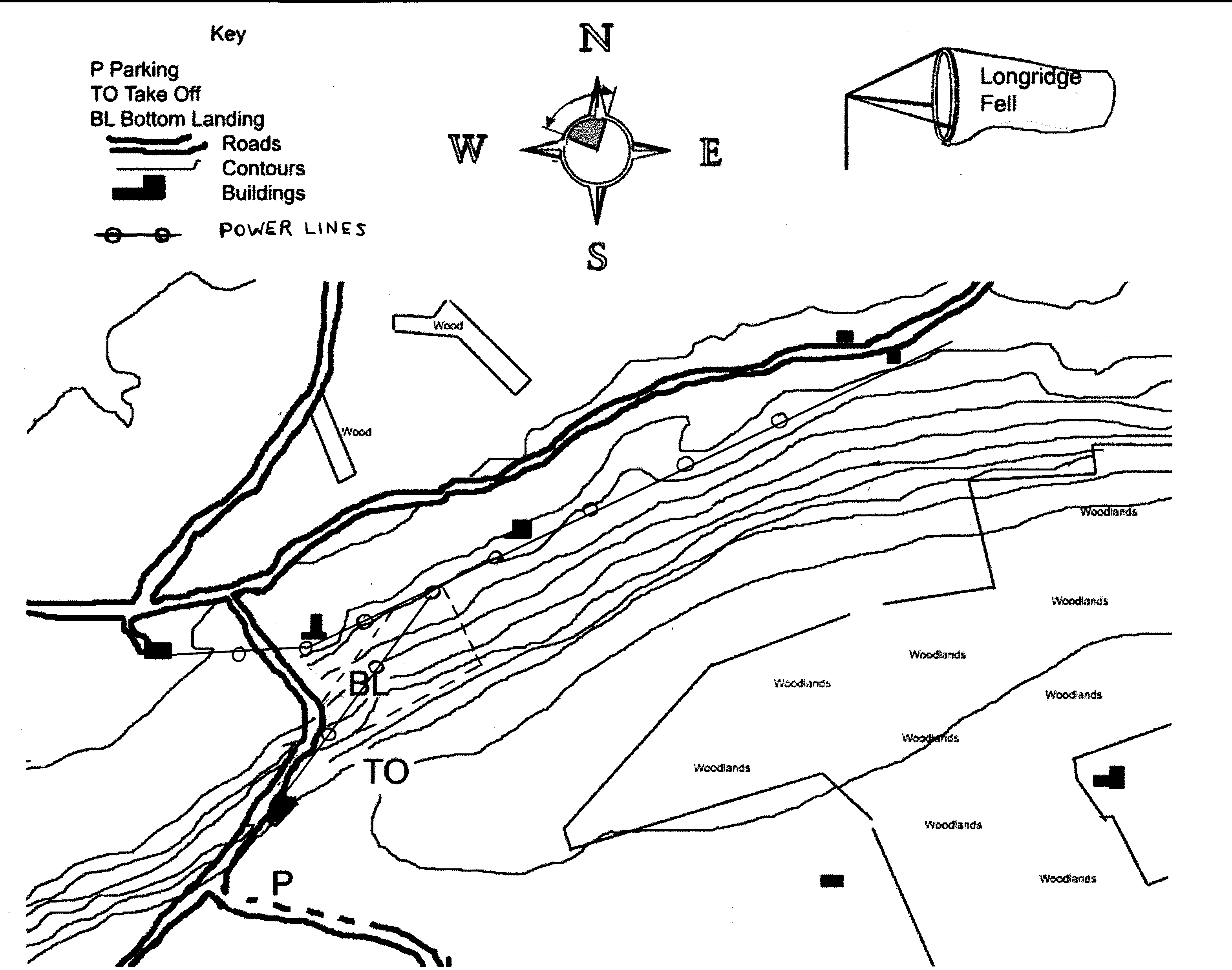
From Longridge follow the signs for Longridge Golf Club. Pass the golf club and continue to the public car park at SD 640402. From Clitheroe take the B6243.
Access
Park in the car park area and go through the gate at the East end of the car park. Follow the track until a path turns towards the ridge at a stone post. The rigging and launch area is the edge of the grass field just before the heather and next to the edge of the ridge.
Airspace
The airspace above the hill is at FL55, Class A. 10 Kilometres behind the hill the airspace drops to 4500 ft ASL at Blackburn, 3500 ft ASL at the M65.
Safety
As the name suggests this is a very long site and has a large top landing area. It is prone to wave and due to the effects of the Bowland massif in front, this can give very rough and variable wind conditions. At the East end of the site the area behind the hill is wooded and care is required especially on a paraglider to avoid being pinned by increasing winds.
When top landing, land well back from the edge to avoid rotor.
The bottom landing field slopes and is unsuitable for hang gliders unless very experienced and capable of a downwind upslope landing in light winds. An area of increased turbulence is found between the take off area and the car park due to the tall trees upwind.
Notes
Restrictions
The site will be closed when grouse shooting is taking place on the moors along the hillside
Advice
The back of the hill is farmed for trees. Beware of being blown back here!
Paragliders
Landing is possible on the side of the hill above the fence but care is needed as the slope is steep. Avoid landing in the heather areas to the East of take off as this area is farmed for grouse. The wind can increase quickly as wave sets in, so care must be taken to avoid being pinned. This is especially true as the wind backs to the West, as commonly happens when the sea breeze starts to take effect during summer months.
The bottom landing field is the large triangular field, which has a gateway onto the roadway at the 90-degree bend. The landing field slopes but is long enough to safely land a paraglider. Be careful not to stall the glider by slowing too much trying to fly down to the slope. There are power lines in the bottom of the field.
Hang Gliders
Longridge is an excellent site for Hang Gliding with much more ridge to work than Winter Hill, however there is no 'suitable' official bottom landing field at the time of writing. Pilots should only fly if soaring flight is possible and even then be confident that they are able to land at the bottom safely if conditions deteriorate whilst in the air. Top landing is easy, but be aware that the slope can result in an 'overshoot' if the approach was made too close to the edge. The slope is worse closer to the car park end of the field. Always approach with plenty of speed to counter the wind gradient.
XC Potential
As the hill takes Northerly (unstable) air flows and slopes away gently to the South it can be relatively easy to get away from on a cross country. It's potential is limited by Manchester airspace, but flights have been made to Winter Hill and beyond.