Pay Attention! More on changing winds

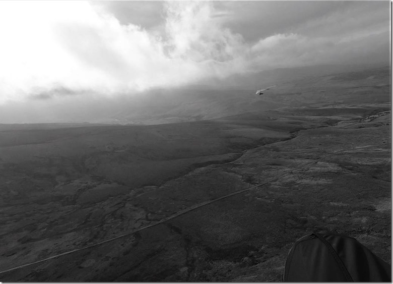
It’s been a very weird winter, wind-wise. Apart from the weather being consistently abysmal, even the breaks have had their issues with wind gradient and shear. Flyable winds at ground level have regularly evolved into howling gales at hilltop height (or, even worse, just above the hill). Last Thursday our chairman and I set off for Tailbridge, passing clagged-in Parlick and Whitestones on the way. GJ had been in the air an hour when we arrived, and while he looked a bit stationary at times, all seemed fine. The wind was strong, but consistent, so I walked down to the bottom of the hill to re-attach my wing as I’d detached it from the harness to repack the reserve. After some ground handling the wind seemed to calm a bit more, so I wing-walked up a bit, and took off. Smooth air, consistent lift, good penetration – what more could I want? Better visibility would have been nice, but no need to be greedy. I had fun for half an hour, sharing the sky with a couple of hangies exploring the lift well out over the road. I started filming Simon as he and his mate flirted with the clouds swirling around between us and Mallerstang, thinking the light was great for some moody, atmospheric shots. This was nearly my undoing: I suddenly became aware of grass only a few feet beneath me, moving in the wrong direction! I barely had time to catch hold of the rear risers and get my feet out of the podbefore contacting the ground. It could have been much more serious – there are many worse places to get blown back than Tailbridge, with its flat grassy top, so apart from falling over while I was killing the wing, no harm done.
What did I do wrong? Failed to pay attention to the conditions. I was alone in the air, apart from the 2 hang gliders which were always in my view, so with reduced need to watch the airspace for other wings, my focus on catching ‘the shot’ distracted me from my main task, which was TO FLY THE B****Y AIRCRAFT! The wind was forecast to increase, and while Tailbridge isn’t noted for wave, clearly it was moving in and out of phase and I should have expected a marked change in windspeed at any time and stayed vigilant.
What could I have done? Had I noticed the speed picking up, I could have used my speed bar to push out and land by the road. By the time I realised what was happening, I was too near the ground for that to help, my priority was to prepare to land.
When I’ve landed in strong winds before, I’ve usually been relieved to find my backwards ground speed decrease to nothing, or even slightly forward, in the last few feet. Not this time, I actually accelerated backwards as I touched down so had no chance to stay on my feet, despite landing with bent knees and jumping round to run towards the wing. Could I have twisted 180° to face the way I was moving? This wasn’t the time to practise that!
So, in conclusion, this was a good reminder to me of the need to stay focused on the task of flying the glider. Everything else is peripheral – sightseeing, photography, even eating and drinking – all things we do but it’s vital develop the skill of keeping a significant part of our brains tuned in to the job in hand.
Anyway, here’s the shot:
